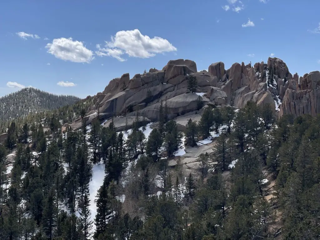
Oh, the Crags. A fan favorite in the Divide, Colorado area. And rightfully so. The Crags, located within Pike National Forest, is a great hike with magnificent rock formations and beautiful mountain views throughout its entirety. It’s not considered “easy,” but that can only mean good views, right?
The Crags is a well-worth-it challenge.
Quick Facts: The Crags
- Location: Divide, Colorado
- Miles: 4.8 mile hike. (Add 1.5 miles in the winter when the road is closed.)
- Type: Out and Back Hike.
- Elevation Start: 9,990 ft.
- Total Elevation Gain: 820 ft.
- Time: Roughly 3 hours, at a good pace.
- Challenge: Moderate Hike
- Popularity: Somewhat-Very.
- RATING: 5 Stars
- Trail #664a
What are you going to see on The Crags Hike?
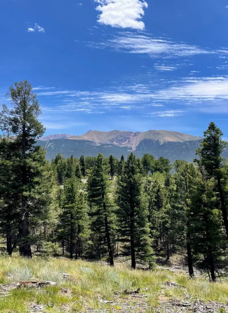
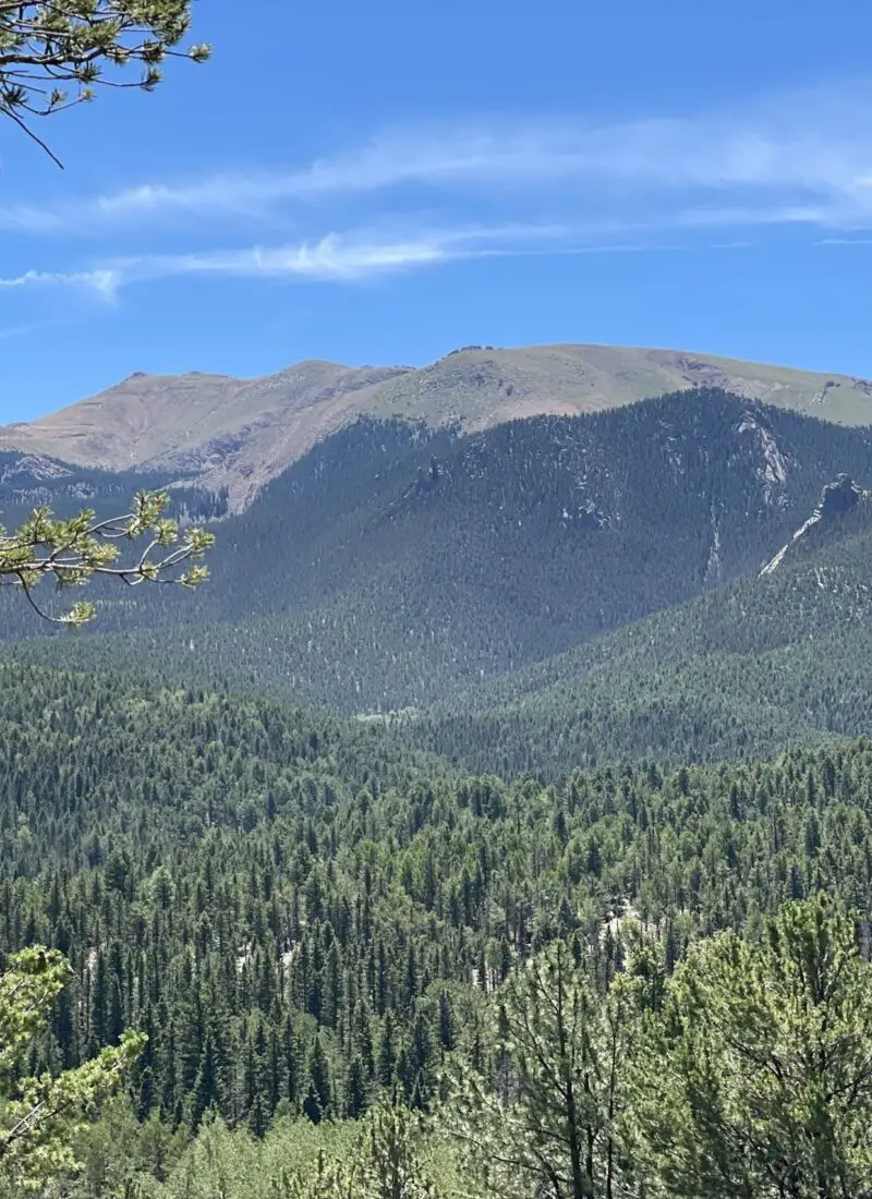
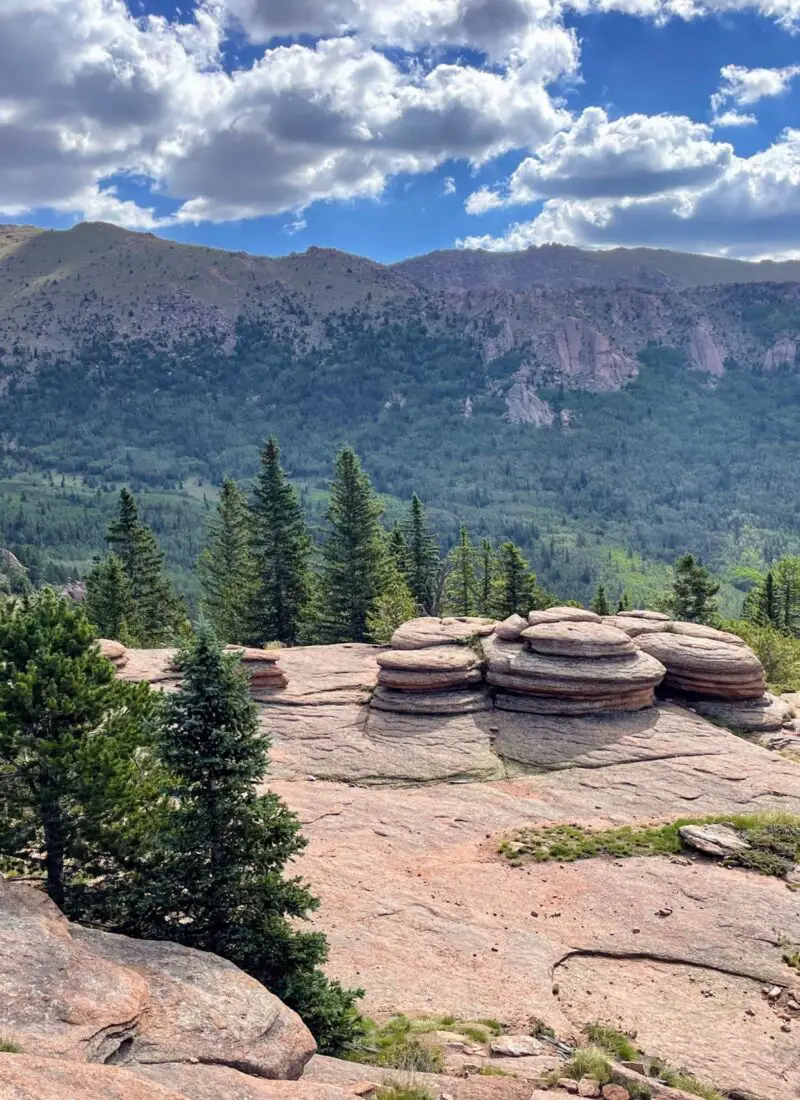
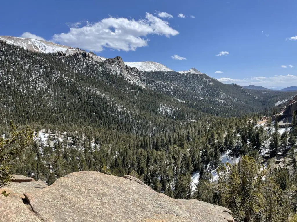
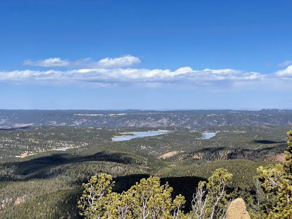
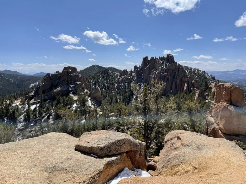
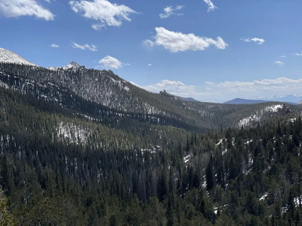
You will see a variety of views on the Crags, which is one of the reasons it’s one of the most popular hikes in the area. As mentioned, crazy rock formations steal the show. You will of course get endless tall trees to admire. A small stream runs throughout. Snowy mountain tops including the summit of Pikes Peak and Mount Shasta.
the top of the mountain scenery is 360-degree views.
Also, keep your eyes peeled for wild animals! Moose are often spotted on this trail. Personally, I saw a lot of moose droppings—but no creatures, unfortunately. (I did get views on Lovell Gulch Trail.) You may also run into mule deer or the occasional elk.
Who Should Hike The Crags?
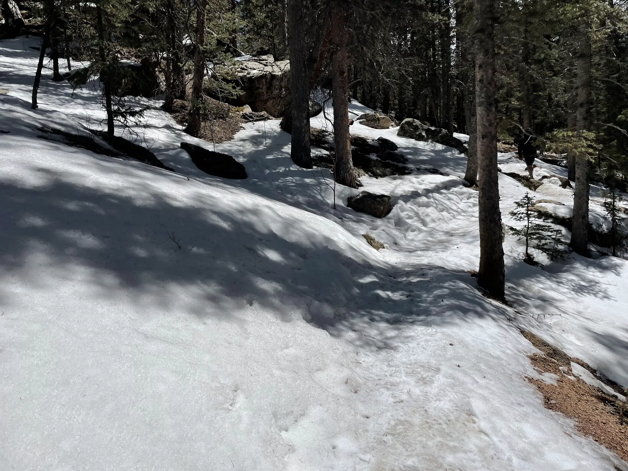
The Crags does have some challenging moments—especially in the winter months. There are a series of switchbacks, as well as a final ascend to reach the peak. I would advise anyone who does this hike not to be a complete beginner. That said, if you’re in pretty good shape, you will be fine and there are plenty of views to keep you motivated.
It’s a beautiful hike and those always require a little hard work to get the reward!
The summer months make this trail quite a bit easier. You avoid the 1.5 additional miles due to the road closure. And the switchbacks and climb to the top are easier without snow, ice, and slush.
How to Get There
From Colorado Springs (it’s Only About 40 minutes)
The Crags is super easy and very accessible from Colorado Springs. Follow US-24 West for 26 miles up through Woodland Park and into Divide. From there, you’ll turn left at the traffic light onto CO-67 and take that for 7 miles until you reach Teller County Rd 62. This becomes a dirt road.
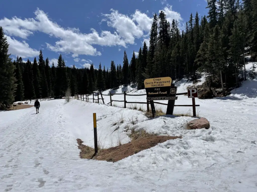
If it’s winter, you will need to park in the first parking lot just passed the Rocky Mountain Mennonite Camp and hike into the trailhead. NOTE: during heavy snowfall months, you will need snowshoes.
If the gate is open, you will be able to get all the way to the second parking lot which leads to a big parking area. There is a bathroom and picnic tables on site.
The Crags Hike
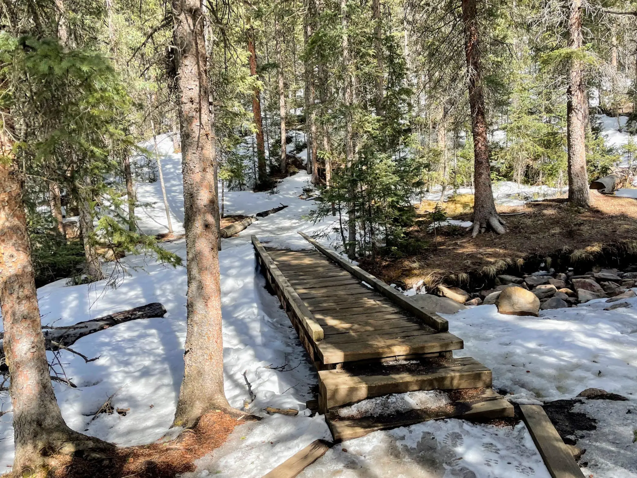
Time to hike—this will help you navigate the trail and enjoy your experience! Once you reach the Crags Trailhead, either by parking at it or walking in, you will see the trail opening and a small bridge leading you in.
You start out with a couple of steep switchbacks. Nothing like getting those legs pumping early! Don’t worry, this is one of the toughest parts and you get to get it over with…
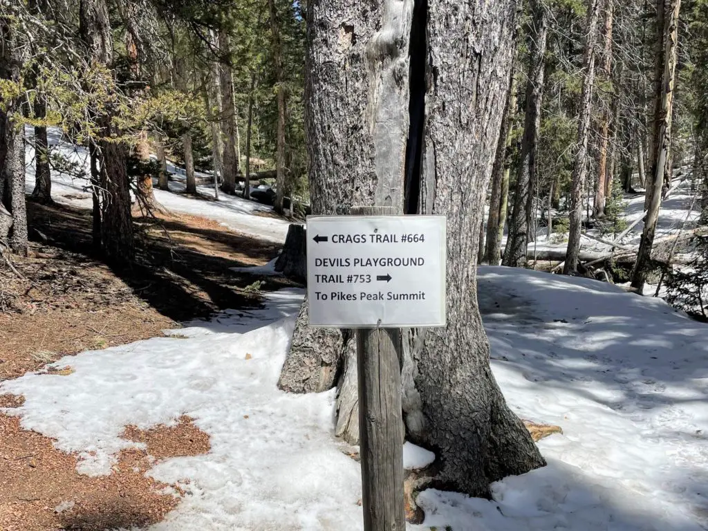
You come out to open forests and a sign pointing you to the CRAGS TRAIL #664. Stay left or else you are going to end up on Devil’s Playground Trail which leads to the Pikes Peak Summit (lol, talk about legs pumping—this is a 14er.)
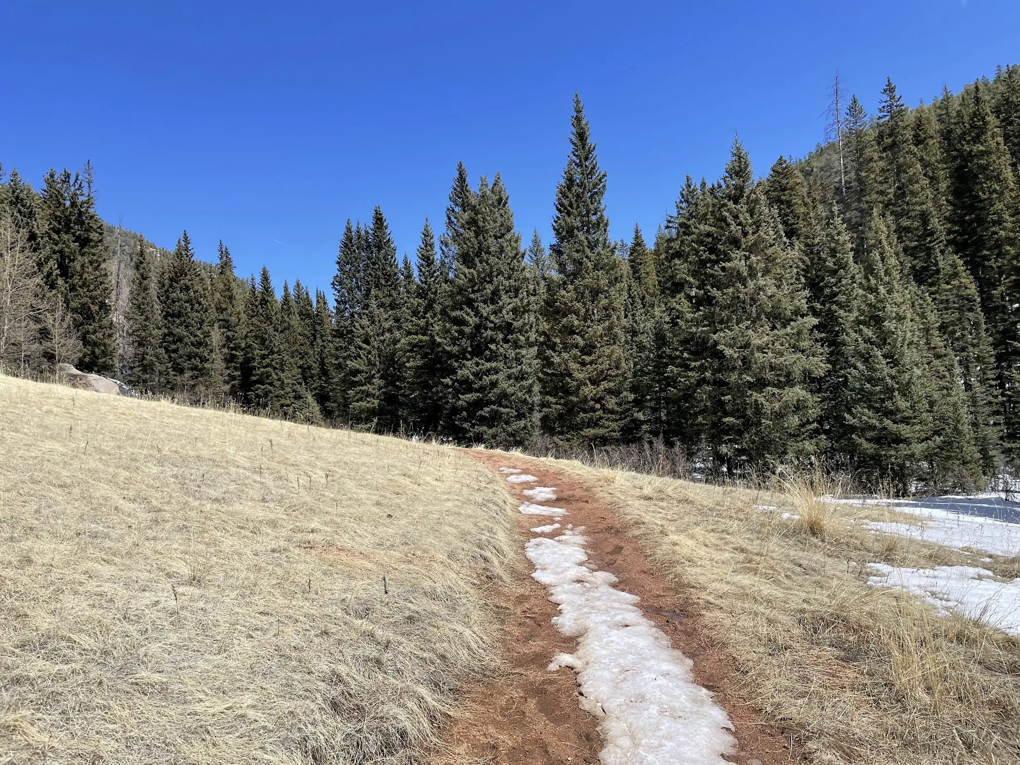
Eventually, you will come out on a wide-open meadow with a skinny rock path that becomes a majority of the Crags Trail. You will start seeing some of the unique rock formations in the distance!
After the meadows, you will end up back inside the trees and it’s time to embark on the last half-mile—UP. Shortly after entering the new terrain, you will see views of the Catamount Resivoirs below which are a great view, but you’re not done and they get much better. Don’t stop here!
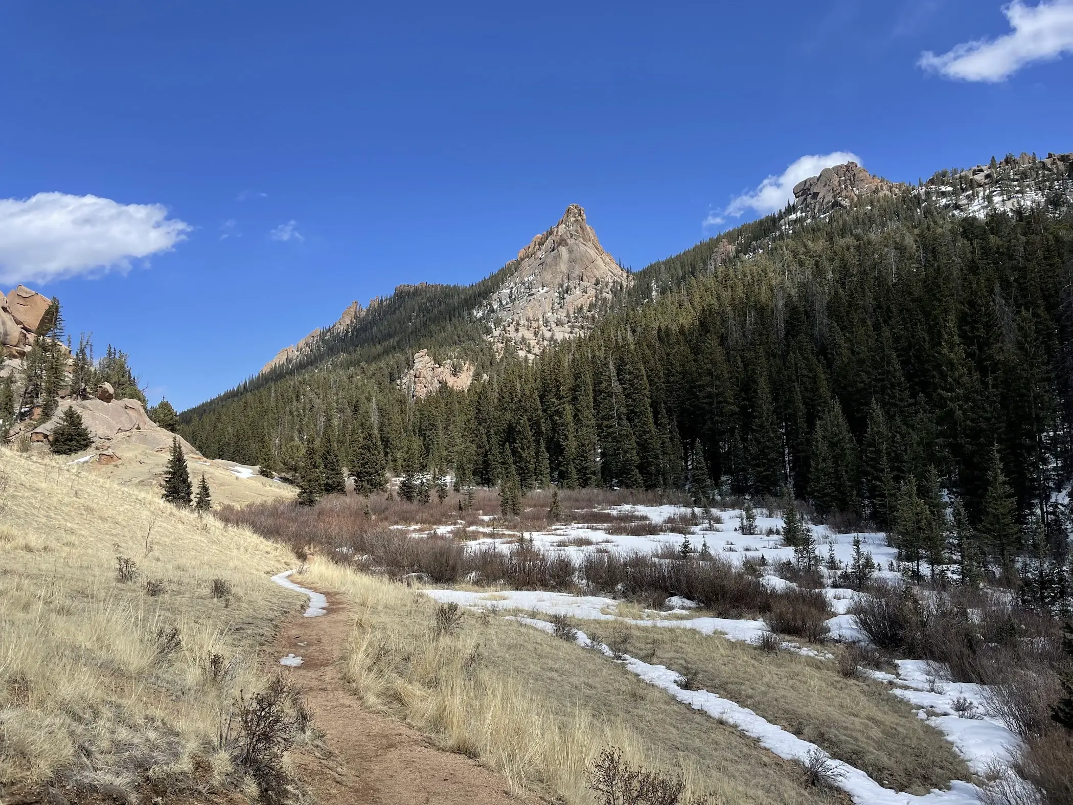
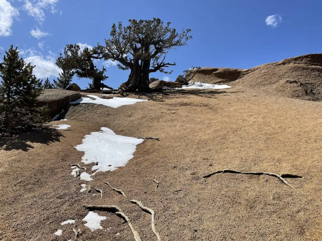
Make the final push about a quarter mile through a series of large rocks and slowly but surely, things will open up and you will reach the end of the trail. Welcome to the Summit! Admire the views of weird rocks, snowy peaks, and endless mountains in the distance. It won’t take you long to realize why this is such a popular trail.
Preparation + What to Bring
- Wear Sunscreen. Even in the winter! You’ll get a lot of sun in the meadows. (Don’t Forget Your Lips!)
- Hiking Shoes. You’ll want quality hiking shoes or boots any time of year. If it’s December-February, you may need snowshoes and definitely spikes. Bring your poles in the winter as well.
- Water: Every person in our group had about 20 oz. which was sufficient. BONUS: Fill it with electrolytes for extra energy.
- Backpack: I carried my backpack to shed layers (more on clothes below), hold water, and bring a few snacks and a light pair of gloves.
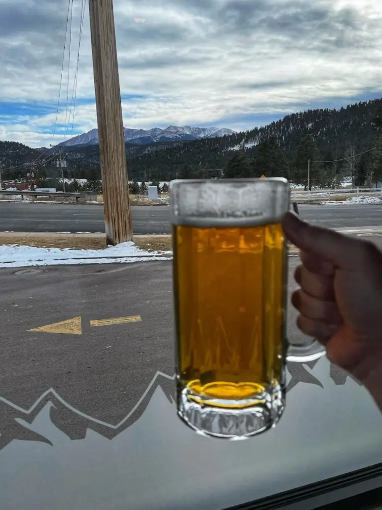
- Money. Which you won’t need unless you need a beer afterward! 🙂
What to Wear
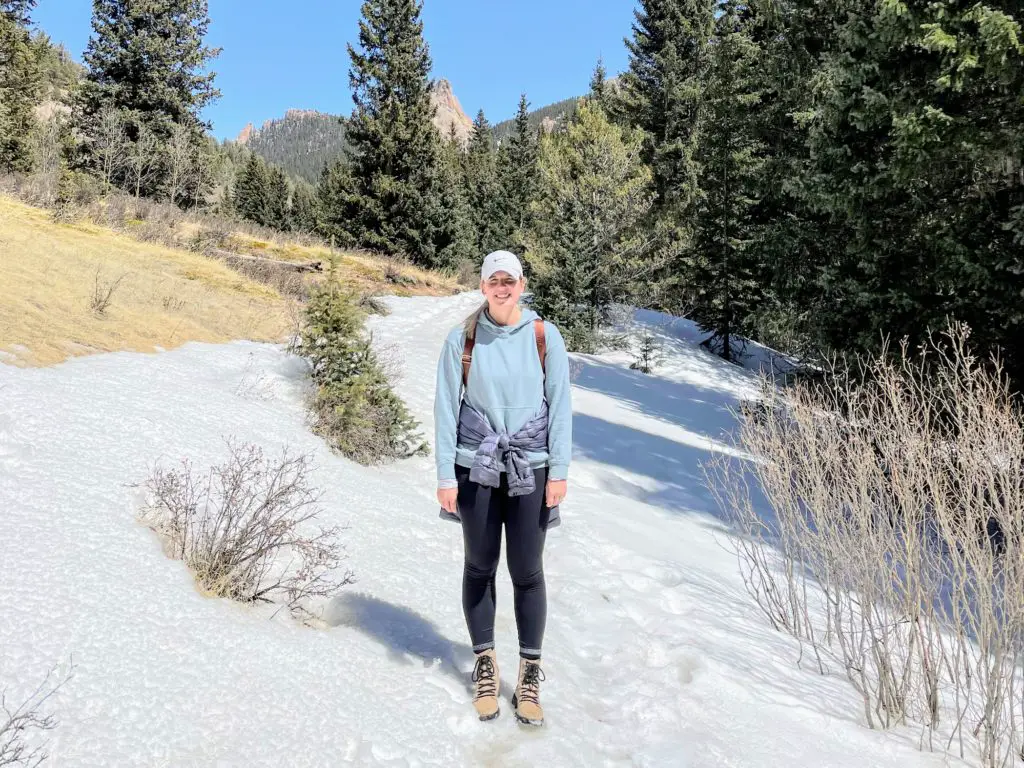
Unless it’s the dead of summer, you will want layers, plus a hat! The nearly 1,000 ft. elevation gain means you will get a variety of temperatures. The beginning of the hike is shaded, while the middle (majority) is completely open and full of sun. And be prepared with an extra layer at the top—there are often high winds at the summit.
During a mid-April hike, a long sleeve with a light, but warm, down jacket was perfect. And a baseball cap helped with the wind.
After You Hike The Crags
You’ll be ready for a cold one! And you have a couple of options for a post-hike stop in the area. Head back out to the town of Divide and just across from the traffic light you will find:
- Russ’s: total dive bar but a ton of fun and the best burgers! This is my top recommendation.
- McGinty’s: an Irish pub serving fish & chips, a great Rueben, and delicious buffalo wings.
- You can also drive past Divide and find a ton of options in Woodland Park. READ The Best Restaurants in Woodland Park to find what you’re looking for.
- There is also Cripple Creek which has a variety of options—and 9 casinos!
The Crags Hiking Guide
Divide Colorado offers quite a few incredible hikes, but this one is easily in the Top 3! It is definitely a hike I recommend and worth visiting if you are in Colorado Springs.
Looking for more of the best hikes in the Pikes Peak Region? Check out Mueller State Park for a variety of options or else give Raspberry Mountain a go—another top option that you actually pass on your way to The Crags. And next time: DEVILS PLAYGROUND! Lol.
Did this post help you out? Support the work and pass along $5 for a Coors Light 😉 VENMO: @Amber-LBB or PAYPAL: amber@littlebluebackpack.com. THANK YOU.